


Earth Camera Live Street View
3.0669.00 Reviews
App Specs
- Version
- 5.1.4
- Updated On
- License
- Free
- Downloads
- 10,000,000+
- Developer
- Easy Language Translator
- Categories
- Maps & Navigation
- Platform
- Android
Screenshots
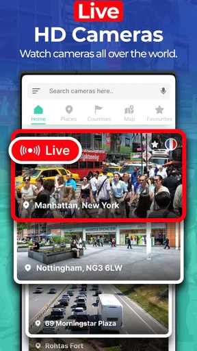
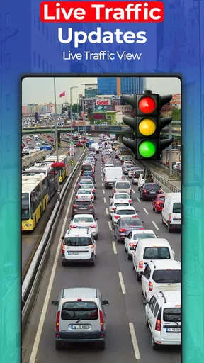
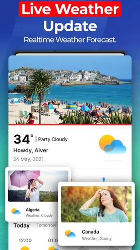


 Analysis by AppCompare
I like the idea behind Earth Camera: Satellite View most when I treat it as a visual way to explore places, not as a substitute for a dependable turn-by-turn navigator. If you are opening it for the first time, a good first goal is simple: search for a place you already know, inspect the view, then try a destination you have never visited. That small test helps you understand what the app is useful for before you rely on it for a real journey.
Start with curiosity, not directions
Earth Camera: Satellite View is a free Maps & Navigation app from Easy Language Translator. It is intended for everyone, and its focus is GPS navigation and a camera-like view of the Earth. The app has reached over 10 million installs, though its average rating is 3.1 from around 27,000 ratings. I take that mixed score as a reason to approach it with realistic expectations: it may be an enjoyable way to browse places, but I would test the parts I need before making it part of a travel routine.
There is a useful distinction to keep in mind from the start. Satellite-style imagery helps you get a sense of a place and its surroundings; it is not automatically the same thing as a live camera pointed at a street. Nor should a visual map be treated as proof that a road is open, a shop is operating, or a route is safe right now. I would use the imagery to orient myself and satisfy curiosity, then check time-sensitive travel details in a navigation service built around current routes and conditions.
A calm first setup and a useful first search
After installing it, I would begin with a familiar location rather than a faraway landmark. Search for your neighborhood, a nearby station, or a destination you have visited before. That gives you a practical reference for judging what the imagery shows and how the controls respond. If the app presents a location or map view, try a modest zoom first; then move outward to see how the surrounding area fits together. This is less frustrating than immediately zooming in on a tiny detail that may not be clear.
For a first meaningful result, look up a place you may visit soon and use the view to understand its broader layout: where the main roads run, whether the destination appears near a large open area, and which surrounding landmarks might help you recognize the area. Treat this as visual preparation, not a final route plan. A map can help you arrive with a better mental picture, while a dedicated navigation app is still the safer choice for live turn instructions and changes on the road.
One small but valuable habit is to keep your search focused. Try the full place name first, then narrow it with a district or city if results are broad. When a result looks plausible, check its surrounding context before settling on it; two places can share a name, and the nearby streets or landmarks may reveal which one you meant. This simple check can save time when you are exploring an unfamiliar city.
What to do when the view seems confusing
People often expect “live” map imagery to behave like a continuous video feed. I would not plan around that assumption. Satellite imagery, street-level views, and a live camera are different ways of presenting a place, and they do not necessarily show the same information or update at the same pace. If the image does not match what you see outside, rely on current signs and a trusted navigation source rather than trying to interpret the picture as a real-time traffic report.
Worth Reading Before You Choose

Flipboard Shows What News Apps Must Do Beyond the Feed

Switching to Android Auto Means Rethinking Your Driving Routine

Google Calendar Makes a Crowded Week Easier to Manage

Ludo King Makes the Most of the Minutes Between Plans

Baby Panda World Brings Quick Play to Modern Phones, but Its Game Library Feels Busy

ESPN’s Live Game View Makes Following Close Games Easier
Likewise, an attractive close-up is not always the most useful view. Pulling back can make it easier to identify a river, a major road, or the general shape of a neighborhood; zooming in is better for examining a specific landmark. I find it helps to switch between those levels instead of staying at maximum zoom. The trade-off is that imagery can be interesting to browse without being precise enough for decisions such as choosing an entrance or confirming a building’s current use.
If the app feels slower or less clear than expected, try a different location before assuming the whole experience is the same everywhere. Coverage and image clarity can vary from place to place. I would also avoid judging a destination from one angle alone: move around the map and check the wider area. That is especially helpful for rural locations, where a single close view may not explain how a place connects to nearby roads.
Where it fits among map apps
Compared with the usual navigation apps, this one makes the visual exploration angle the main attraction. A conventional route planner is usually the better tool when you need reliable directions, arrival estimates, or current traffic guidance. A globe or mapping service designed for research may offer a more familiar way to inspect geography. I see this app as an extra viewpoint for browsing and getting a rough sense of a destination, rather than the one map I would trust for every task.
That distinction makes it a better fit for a few kinds of users: someone browsing a holiday destination before booking, a curious person comparing how neighborhoods are laid out, or a family looking for a visual prompt to talk about places around the world. It is less suitable if your main need is hands-free navigation on a commute, detailed offline planning, or certainty about present-day street conditions. In those situations, choose a navigation product whose strengths are explicitly centered on route guidance.
A realistic everyday use might be checking the area around a café before meeting a friend in a neighborhood you rarely visit. I would use the app to get a broad visual impression, then confirm the address and route with a current map. If the meeting point is near a landmark, noting that landmark can make the final approach less stressful. The useful part is not pretending the imagery replaces directions; it is arriving with a clearer picture of the surroundings.
Costs, expectations, and my recommendation
The app is free to download, with in-app purchases listed from $9.99 to $39.99 per item. I would explore the basic experience first and only consider a purchase if I understand exactly what it adds and expect to use that benefit regularly. Since the app is centered on browsing and map views, casual users may be perfectly happy treating it as an occasional exploration tool rather than paying to make it part of their daily routine.
It was released on October 29, 2019, and version 5.1.1 requires Android 8.0 or later. The developer is Easy Language Translator. Those details make it worth checking your device’s Android version before installing, especially if you are setting it up on an older phone. The age rating is Everyone, so its subject matter is broadly accessible, but parents should still decide whether any app’s features and purchase prompts suit their household.
My practical recommendation is to give it a short, low-pressure test: search a familiar place, inspect a destination you might visit, and compare what you see with a current map before using it to make plans. If the visual browsing is what you wanted, it can be a pleasant companion for armchair exploring. If you expect a live street camera or navigation-grade certainty, you may be disappointed. Knowing that difference before you begin is the best way to get something worthwhile from it.
Taking a Peek at the Planet
So, what’s the buzz with Earth Camera: Satellite View? Imagine zooming in on the bustling streets of Tokyo or checking out the serene beaches of the Maldives—all with just a few taps. The app uses satellite imagery to give you real-time footage of different parts of the world. It’s like Google Earth, but with a flair of excitement!
When I first opened the app, I was greeted with a super intuitive interface. You don’t need a PhD in tech to navigate it. Just swipe, pinch, and zoom to your heart’s content. The images are crisp, and the live feed is surprisingly smooth. It’s a treat for the eyes!
Features That Make It Shine
Let’s dive into some of the cool features that make this app stand out. First off, the real-time streaming is a game-changer. Whether you want to check out the Eiffel Tower or see how crowded Times Square is, it’s all just a tap away. The app also offers historic imagery, which is pretty neat if you’re into seeing how places have evolved over time.
Another feature that I found super handy is the bookmarking option. You can save your favorite locations and come back to them anytime. It’s like creating a travel itinerary, minus the travel. Plus, the app’s got a nifty search function, so you can easily find places you’re curious about.
Why It's Worth Your Time
If you’re a travel buff or just someone who enjoys a good virtual adventure, this app is a must-try. It’s perfect for satisfying your wanderlust, especially when travel plans are on hold. The app runs smoothly on both Android and iOS, so no worries about compatibility issues.
One thing I appreciated is how user-friendly the app is. The developers have done a stellar job making sure everything’s easy to access. From toggling between different views to checking out specific landmarks, it’s all seamless.
Room for Improvement
Now, no app is perfect, right? While Earth Camera: Satellite View is pretty impressive, there are a few areas that could use a little tweak. For starters, the ads can be a bit intrusive. I get it, free apps need ads, but a less aggressive approach would be nice.
Additionally, while the real-time feature is fantastic, some locations aren’t available yet. It’s a bit of a bummer when you’re all set to explore a spot, only to find it’s not on the list. Hopefully, they’ll expand their coverage soon!
Final Thoughts
All in all, Earth Camera: Satellite View is a fantastic app for anyone curious about the world. It’s educational, fun, and a great way to pass the time. Whether you’re planning your next vacation or just exploring for fun, this app’s got you covered.
So, if you’re itching to see the world without leaving the comfort of your home, give this app a go. You might just find yourself lost in its endless possibilities!
Pros
- High-resolution satellite imagery.
- User-friendly navigation interface.
- Real-time location updates.
- Diverse map styles available.
- Offline mode for data saving.
Cons
- Limited free features.
- Heavy battery usage.
- Occasional app crashes.
- No street-level view.
- Slow loading on older devices.
FAQs for Earth Camera Live Street View
What is Earth Camera: Satellite View?
Earth Camera: Satellite View is a mobile application that allows users to explore real-time satellite images and street-level views from around the world. It provides a unique perspective on global landmarks, cities, and natural wonders, offering both entertainment and educational value. The app is available for both Android and iOS devices.
How accurate and up-to-date are the satellite images?
The app utilizes data from reputable satellite service providers, ensuring high accuracy and relatively current images. However, the refresh rate of these images can vary depending on the location and the satellite's orbit. Users should be aware that some remote areas might have less frequent updates compared to major cities.
Does the app require an internet connection to function?
Yes, Earth Camera: Satellite View requires an active internet connection to stream the latest satellite images and live street views. A stable Wi-Fi connection is recommended for the best experience, especially when accessing high-resolution images or using features like live navigation.
Are there any subscription fees or in-app purchases?
The app offers a free version with basic features, but users can opt for a premium subscription to unlock advanced functionalities, such as ad-free browsing, higher resolution images, and exclusive content. Prices for these subscriptions can vary, so it's advisable to check the app store for the latest pricing details.
What devices are compatible with Earth Camera: Satellite View?
Earth Camera: Satellite View is compatible with most modern Android and iOS devices. To ensure smooth operation, it is recommended to have the latest version of the operating system installed. Older devices may experience reduced performance or limited functionality, so checking compatibility before downloading is essential.


